Having a vulkan implementation of this is quite impressive ^^
Does this allow for non planar terrain ? Like if I put 6 of these can I have a planet terrain based of a heightmap ?
LODding Terrain for 3D in Godot
- Edited
It is not Vulkan (yet), I'm doing it in OpenGL 4.5 first. This isn't for mobiles anyway.
And yes, my plan is to expand this to a spheroid or even ellipsoid cube map with a quad tree per face. For this to be doable with reasonable effort I need double precision on the graphics card in the vertex stage, which I hope will be there when I am there :-)
Just to make that clear, I will not do the data part because it is a bit too much for a part time hobbyist. If you want fractal or noisy or even terrain based on physical processes like erosion and tectonics you'd have to help out ;-)
I will ponder an interface to place models of things, buildings, caves, and scatterings like plants and rocks. Wouldn't make much sense without.
But first the basis, sorting out the parts to display and finding the visible surface.
Pixophir So it is best to keep that as small as possible. The question "handles or pointers" arises with really large terrains. Such environments may be nice to behold but would be pretty dull when not filled with things. So I asked myself is it worth the effort.
Well, in that case may I raise the question: if you were considering supporting really large terrains in a future version, say "2.0", can this be also handled then or is it better to deal with this now even if the actual/official support for really largetm terrains would come at a later TBD date?
- Edited
Size of the terrain is a bother when streaming data, filling the buffers for drawing, and wrapping them around I think. So if you turn around too quickly you might realize, for a fleeting glimpse, that the Langoliers have already been at work 
But that, I fear, cannot be delayed much ... would be like selling a car and charging extra for ... oh, bad example 
... will stay with pointers.
- Edited
I may have a very early alpha by the end of the next week.
May I be so bold as to ask a colleague if they could lend me a hand and try to compile it under windows ? I plan to push the source code to sourceforge.net. It is stand alone for now (no Godot extension yet), just flat shading and no streaming of data yet. I'd just be interested in hearing if it compiles on Windows, maybe with the MS compiler if that's what most people use.
Dependencies are GLFW3, ImGui, stb_image, libpng, glad and OpenGL development/header files. I can add glad, so that's one low hurdle less, but the rest came from the repositories of my OS (Debian Bookworm), so on Windows there may be some prior configuration efforts necessary.
I don't expect many problems some GNU extension to C++ (like sincos()), but GLFW should take care of the windowing/input handling in a transparent manner.
- Edited
Pixophir May I be so bold as to ask a colleague if they could lend me a hand and try to compile it under windows ?
What does it take to do that? In my whole life I have only compiled ArmorPaint from source. 
- Edited
Hi,
let's see, can you follow this tutorial until the hello-triangle (and further on if you wish ofc.) ?
You would additionally have to install the other mentioned dependencies for my cdlod, without the loader glad. Then you're set, at least you could forward me the MS compiler's error messages.
But I cannot help you debugging your environment, should problems arise there. So, you either can compile and run the triangle, or you can not, I am as sorry as possible :-)
- Edited
I certainly get it, no worries. I mean, we'd obviously need some deeper C++ understanding here that I did not mention. Nevertheless, if you like to dive in, there you go. Have fun :-)
Here is an open source C++ project and they have a "Procedural terrain generator". Might be interesting.
No worries !
- Edited
Refactoring. Pls. stand by :-/
Am currently simplifying the conversions between raster space, the space represented by the raster of the spacial data structure which are basically integers for the positions in heightmap textures, and world space, which is the usual floating point stuff one deals with in any 3d application.
Before there was the possibility to extend a terrain in all directions, but that lead to conversion problems I could not really wrap my brain around. Si si, somos aficionados ...
So, in future I will start any quad tree's raster at 0,0,0 and extend it out to max, which is limited to power of 2 sizes. That makes things considerably easier, also when I think of presenting everything to people who probably just want to slab in a bunch of textures and expect it to just work.
Since I also have a new home to build, this may all take a bit longer.
Lesson learnt: Do not say it will be done until it is done.
- Edited
The last overworking got me one step forward. That's from the rim of the canyon where I stood :-)

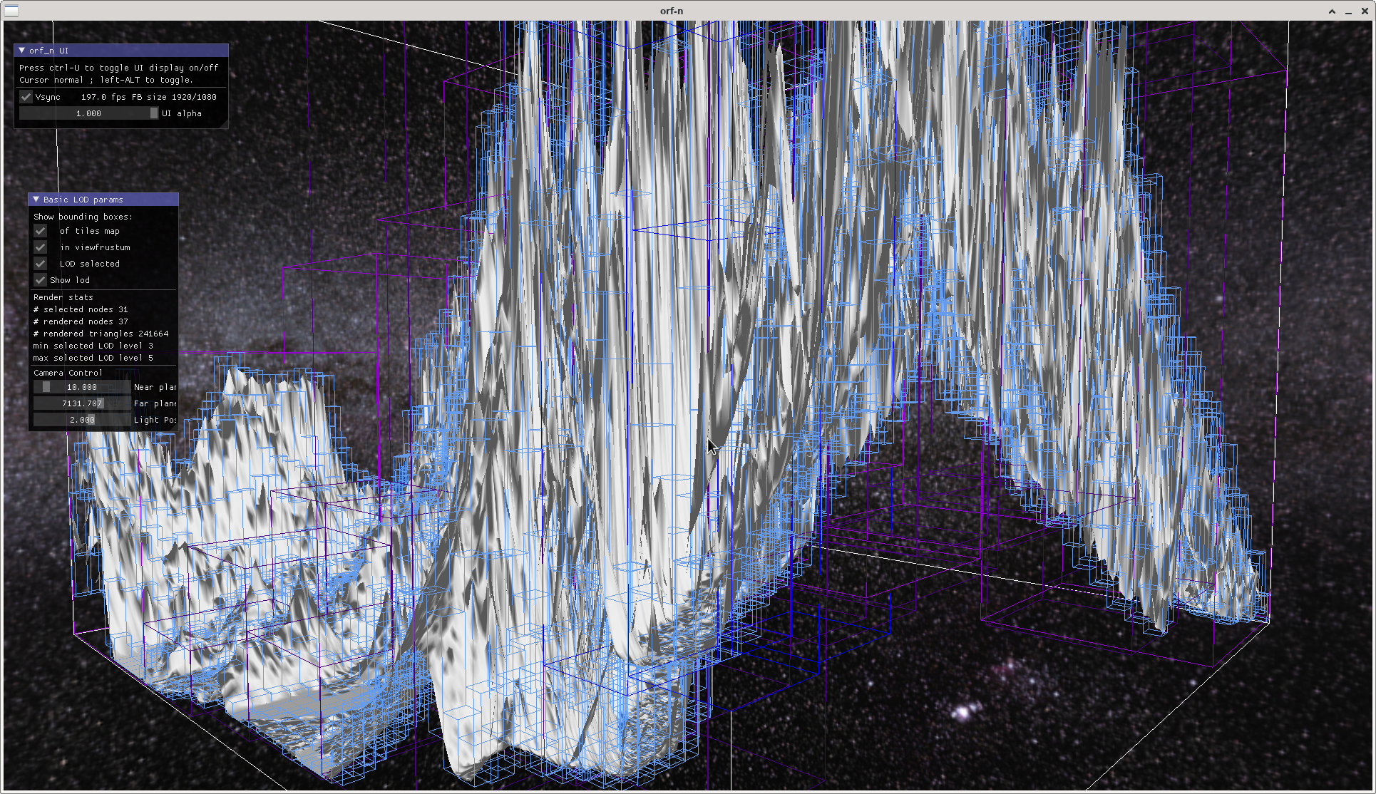
Never mind the flat shading. Shown is one terrain tile made from a 16bit heightmap 4096*4096 pixels, but it works well up to a tile size of the maximum the graphics card can digest. My test data is SRTM (Shuttle Radar Topographic Mission) data, shown is a part of the Himalaya, distance between two posts is about 90m. Purposefully exaggerated to better show the boxes that cover the terrain for view frustum selection.
The white lines are bounding box of the whole tile, the light blue ones are all the boxes of each node of the spatial data structure, the coloured ones are the per frame selected lod levels as seen from camera position.
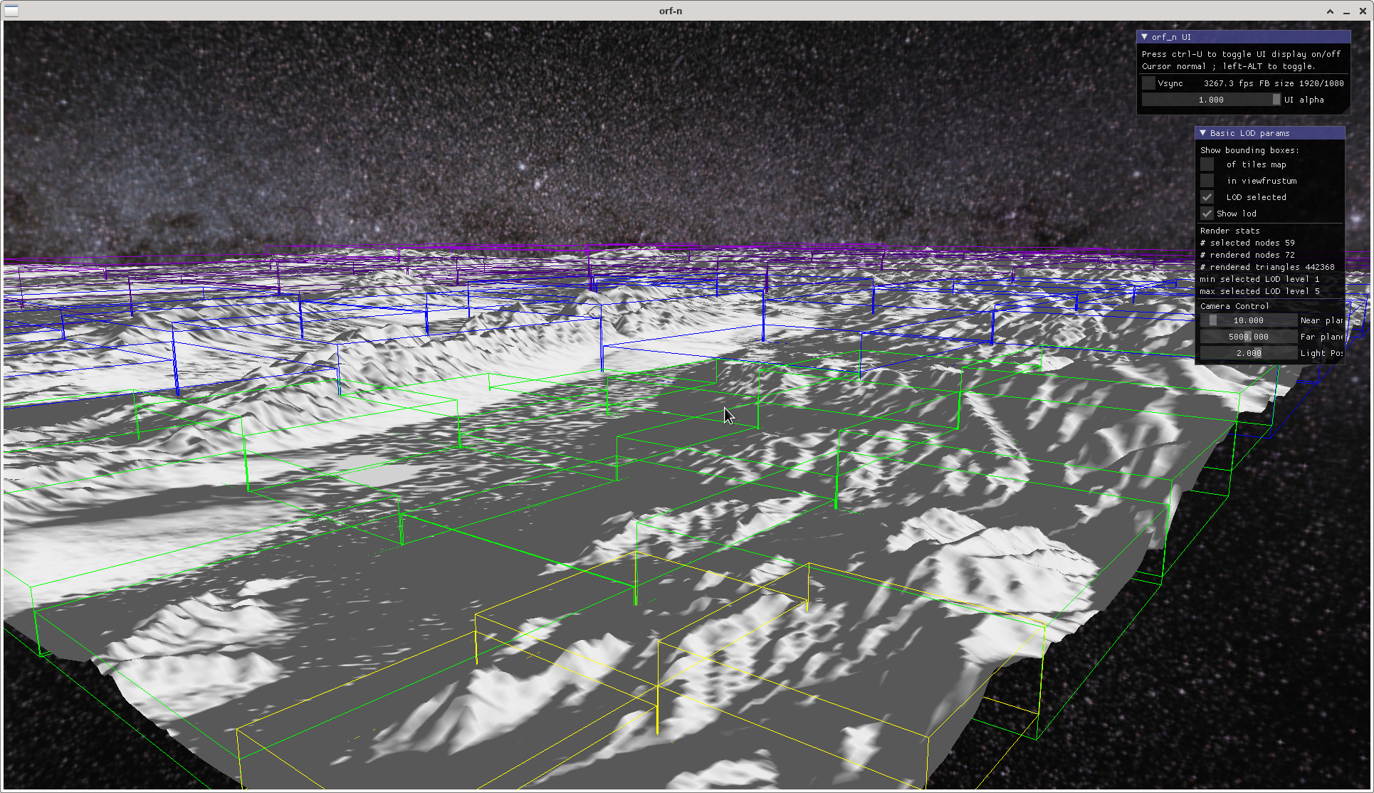
Sending two 0s away gives us:

with the bounding boxes of the lod levels.
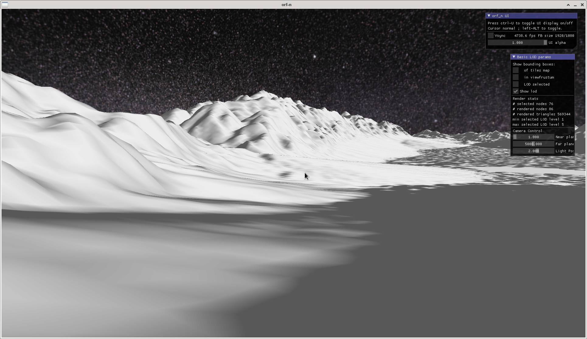
A close-up of a valley gives an impression of what the terrain lod is planned for (no planetary curvature yet, or any sophisticated shading, that's future music for now):

- Edited
So, the base algorithm is finally working.
https://github.com/BaronVerde/cdlod
Tagging @Haystack , whenever you like.
A 4k heightmap texture comes with it. Ask me if you want a 16k texture, or search SRTM 90m data download, select the region you want, choose ARC ASCII as format, and see my other rep srtm-converter for how to generate .png tiles from the SRTM ASCII data. Also, try noise textures you may have somewhere. Eventually tweak the HEIGHT_FACTOR in settings.h.
Loading of a large heightmaps takes a few seconds, though that's going to change. Please mark the b* and krams directories under src as exclude from compile or you get multiple definition errors. These are just backups from working states.
It is only a single heightmap texture for now, and only flat vertex shading. No cosmetics. If you use an own heightmap, make sure it is 16bit-grayscale png of power-of-2, edit RASTER_MIN and MAX values in src/applications/cdlod/settings.h, and add a .bb text-file next to the heightmap texture. Look into src/renderer/renderer.cpp and change the filename there. Don't add .png. Attention, though there is a vector defined there, only one texture is loaded.
Next steps:
Comb the code. There are quite a few implicit conversions I must get rid off. - done -
Texture compression. - scrubbed, using half floats and uint16_t -
Parametrize and correctly calculate raster-to-world sizes and distances. My poor brain ...
Abstract texture types and bit depths and quite generally heightmap sources.
Build a data structure for heightmaps, and load/unload them asynchronously.
Render relative to eye. That means an own terrain camera.
Then: try to get it into the Godot scene tree.
Then proper texturing, rendering, evtl. cascaded shadow maps that fit the lod levels and ranges, collisions, placing of game objects.
Need a beer.
- Edited
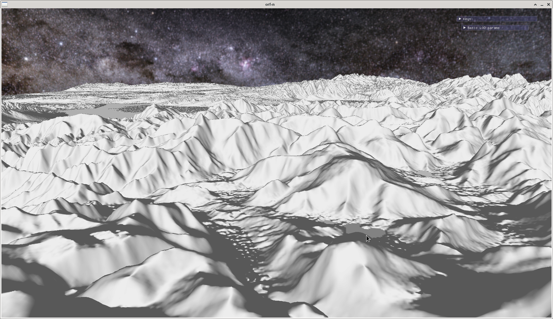
Effect of a resolution multiplier that equally divides the space between two heightmap posts and thus "fakes" a higher resolution than there actually is. It is just a linear interpolation. Considerably improves visual experience (look at the detail in the distance), raises number of triangles rendered, and adversely affects performance :-/

4*resolution multiplier, 11 million triangles per frame, frame rate drop from around 5000/s to 1000/s compared to the other screenshots which are from the same heightmap.
- Edited
Pixophir Considerably improves visual experience ... and adversely affects performance :-/
Look, sometimes it's worth it, ok? 
1ms vs 0.2ms is not a big deal.
Certainly. Specifically comes in handy when using procedurally generated maps from noise or fractals. And there are other methods to control the density in a distance. Otoh, proper shading isn't yet done, nor shadows. So, it will not stay that comfortable.
But of course, having a higher resolution heightmap right from the start would be best. The resolution in the example is also not exactly game-friendly, it is around 90m between posts. A small thorpe or village would just be a speck from that perspective.
Have also experimented with different methods to calculate the normals, which is done on the fly in the vertex shader so I don't have to do normal maps for the terrain. Will offer several methods further down, to control better the "crispyness" of the image.


